
The small Orkney island of Graemsay lies in Hoy Sound at the western entrance to Scapa Flow between Mainland and Hoy, the two largest islands in the archipelago.
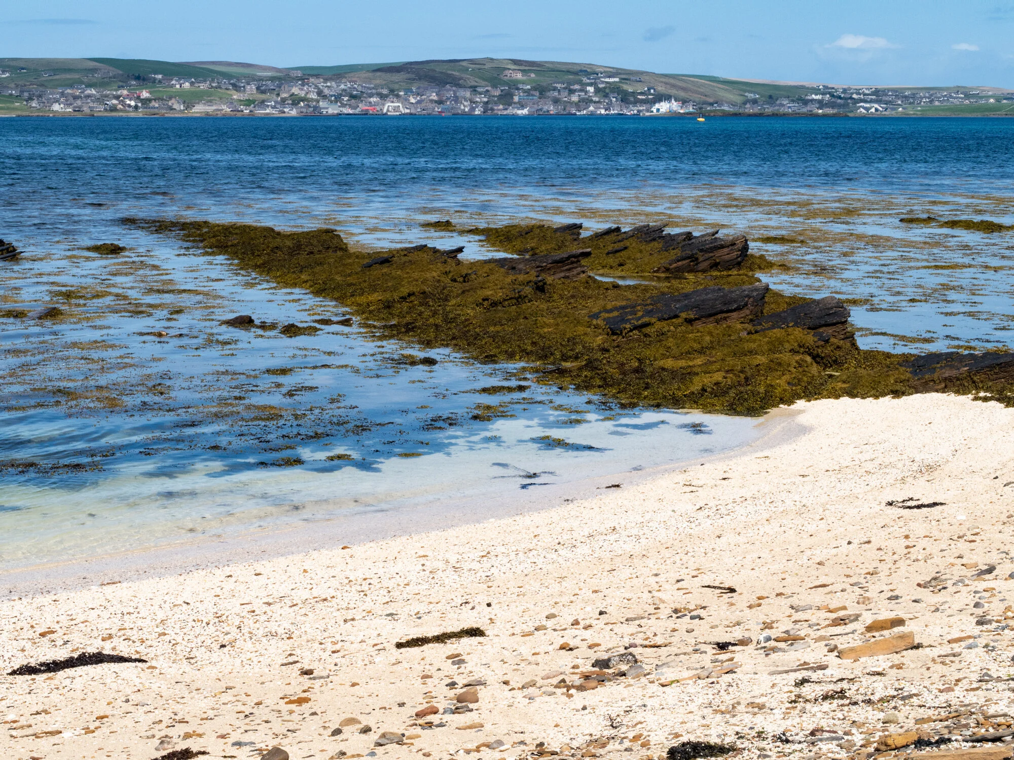
Looking south over the lighthouse slipway from the smaller beach at Sandside Bay, the high hills of Hoy can be glimpsed beyond the Graemsay farmland, while to the north the town of Stromness, on the Orkney Mainland, can be seen

Despite its size Graemsay hosts two lighthouses, Hoy Sound High (115 feet) to the northeast of the island and Hoy Sound Low (40 feet) to the northwest. Both were designed and built by Alan Stevenson for the Northern lighthouse Board and the lights were first lit in 1850. Less than two miles apart, they are termed ‘leading lights’ since they are placed in such a way that the two lights, if kept aligned from aboard ship, allow safe navigation through the Sound, which is notorious for its tidal race, sunken reefs and hidden skerries.


At the time when the lighthouses were built, Graemsay had over 200 inhabitants mainly working on the 36 crofts but in modern times the population has gradually dropped to around a tenth of that. Many ruined crofts are scattered over the island, especially over the rough moorland in the centre. This contrasts with the rich farmland along the coast where the present community, consisting of one working farm and six crofts, continue to thrive.


Sandside Bay is a large bay to the west of Hoy Sound High Lighthouse. The larger of its two beaches is of fine white sand backed by sand dunes that threaten to engulf the only road around the island. Its windswept strand is patterned like waves, the tide drawing the sand back to the sea.


The smaller beach beside the old slipway, which was used to land materials needed to build the lighthouses, is very different being backed by a rocky grass bank above which farm buildings stand, some in ruins, and against which disintegrating machinery and boats lie. But most extraordinary is the beach itself, which comprises shell sand and sun-bleached maerl.


Many of the famous white beaches in Western Scotland are formed of fragments of dead maerl brought ashore after storms and crushed by the waves. Often, as in Graemsay, the crushed maerl was used traditionally as a source of lime, along with seaweed, to condition and fertilise the acid soil for agricultural purposes. The bright dead maerl is everywhere here, scattered on the rocks, amongst the cowrie shells (‘groatie buckies’) and between the green seaweed in the shallows. In lumps and nodules or as delicate branched structures, it forms chalky white sculptures at the edge of a transparent sea that seems to crystallise the light as it rolls lazily over the shore.


I had heard of ‘maerl’ before and imagined it to be some sort of coral but in fact maerl is a calcareous seaweed, which is purple-pink when living and deposits lime in its cell walls as it grows. It lives, unattached to any substratum, in sheltered sub-tidal areas, above deep gravel layers of dead maerl. These beds of living and dead maerl are an important marine habitat for many animals, including young scallops. How ironic then, that dredging for scallops causes significant damage to their maerl bed nurseries that now require our protection, not least to sustain the scallop industry.
